China and Brazil have been cooperating in space projects for nearly 40 years, and there has been new progress. According to the Hong Kong-based South China Morning Post, on August 14th, both China and Brazil are jointly developing the CBERS-5 satellite. This satellite is planned to be launched from China in 2030. It will be able to continuously monitor South America throughout the day and night, providing real-time data for weather forecasting as well as monitoring and warning of disasters such as droughts and storms.
This satellite will be a new component of the China-Pakistan Earth Resources Satellite Program launched in 1988.
Brazil National Institute for Space Research (INPE) Executive Director, Adelmir Souza Roberto da Silva, stated that CBERS-5 will improve weather prediction and disaster monitoring capabilities, establishing a "life-saving" warning system.
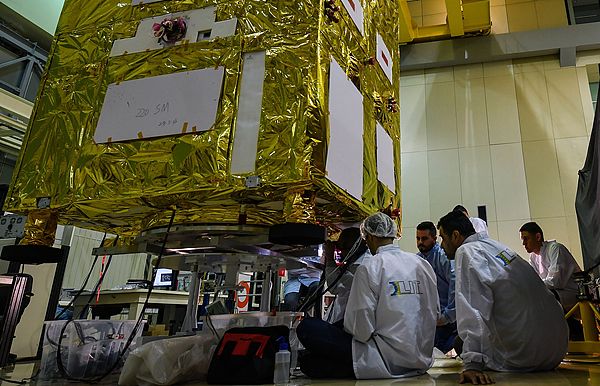
Brazilian researchers are involved in a collaborative project between the Brazilian National Space Agency (INPE) and the China Academy of Space Technology (CAST) for the CBERS Earth Resource Satellite. Visual China.
Unlike previous China-Brazil Earth Resources Satellites, CBERS-5 will be the first geostationary orbit satellite developed through cooperation between the two countries. The satellite will operate about 36,000 kilometers above the equator, keeping in sync with the Earth's rotation. Therefore, it can continuously observe the same area, unlike low-earth orbit satellites which can only obtain data when passing over the target region.
Although the final technical indicators have not yet been determined, Dalsey said that the data provided by them will meet or exceed the level of data that Brazil currently has access to. Once the satellite is operational, Brazil will be responsible for its control, and the relevant data will be made available to the public.
The Brazilian Space Agency previously stated that CBERS-5 will enable Brazil to be among the fewer than 10 countries worldwide with the capabilities to develop related technologies, and it will also enhance Brazil's independence in providing space data for meteorology and environmental fields.
So far, China and Pakistan have collaborated to develop several Earth observation satellites. The CBERS-4, launched in 2014, and the CBERS-4A, launched in 2019, are still in operation. They are mainly used for monitoring activities such as deforestation, fires, water resources, and changes in land use. Currently, both parties are working on developing the CBERS-6. This satellite will be equipped with a synthetic aperture radar, enabling it to capture ground images even when there is cloud cover or no sunlight.